
Key Plan Key Plan
KEY PLAN

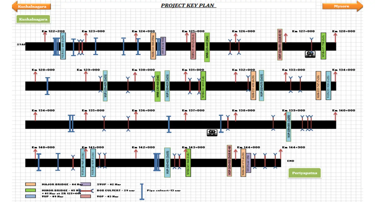
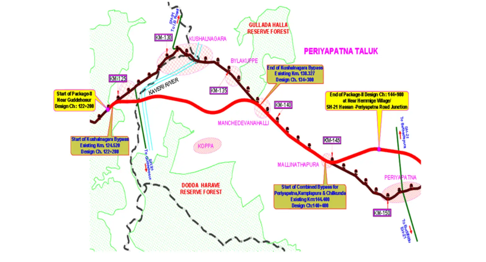
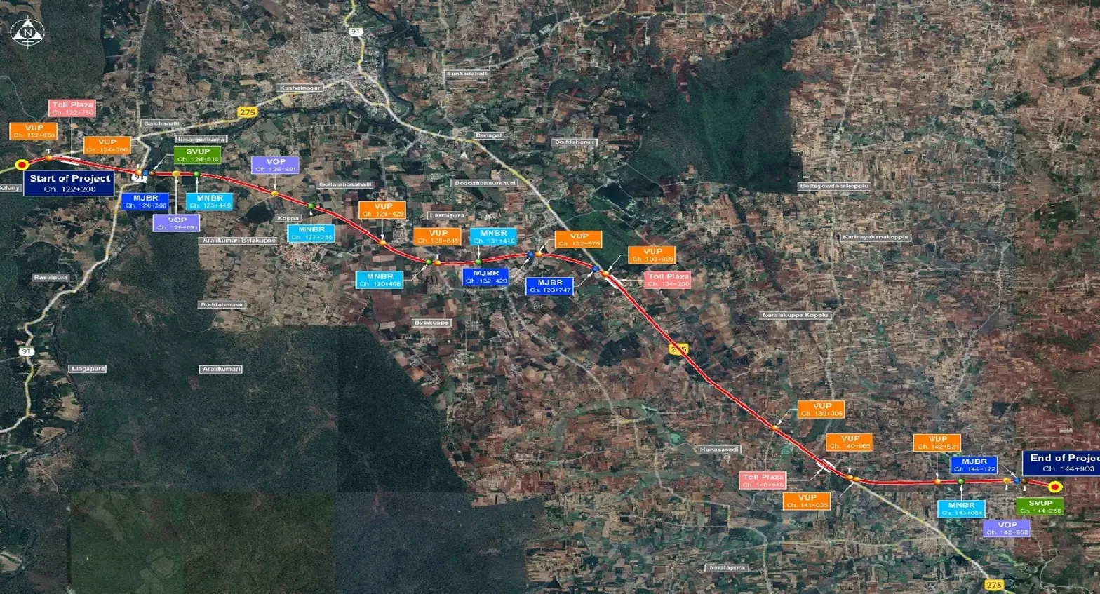
Project Key Plan & Alignment

The Mysore – Kushalnagara Highway project corridor passes through key regions of Karnataka, connecting Mysuru to the Kodagu district. The alignment includes both existing highway improvements and newly developed greenfield bypass sections.

The key plan highlights major junctions, towns, and the complete route alignment, ensuring efficient traffic movement and improved regional connectivity.

  • ✔ Start Point: Guddehosur (Km 122+200)
  • ✔ End Point: Hemming Village / SH-21 Junction
  • ✔ Total Length: 22.7 Km
  • ✔ NH-275 Corridor Development
KEY PLAN HIGHLIGHTS

Strategic Route & Connectivity

The Mysore – Kushalnagara highway alignment is strategically designed to improve connectivity between key regions of Karnataka. The route ensures smooth traffic flow while bypassing congested urban areas.

  • Connects Mysuru to Kodagu region
  • Includes greenfield bypass sections
  • Reduces travel time and congestion
  • Enhances regional connectivity
Key Plan Highlight
Project Stretch

Guddehosur to Hemming Village

Total Length

22.7 Km Highway Corridor

Scroll to top